

1910 Map of the Lower Volga (A. Wambold)
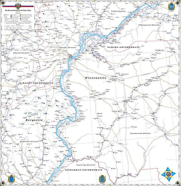
The 1910 map of the Lower Volga designed by Alan Wambold is every Volga German researcher’s dream tool! It is clean and crisp – helpful in your search for specific villages or geographical sites.
The map notes the religious denomination or ethnicity of the original settlers of each village (Protestant, Catholic, Mennonite, and Russian). It indicates if the colony was founded under the Russian crown or by a private recruiter.
Dimensions: 42” by 42”
$20Members save $2.00!
Become a member