

Map #06 Volga
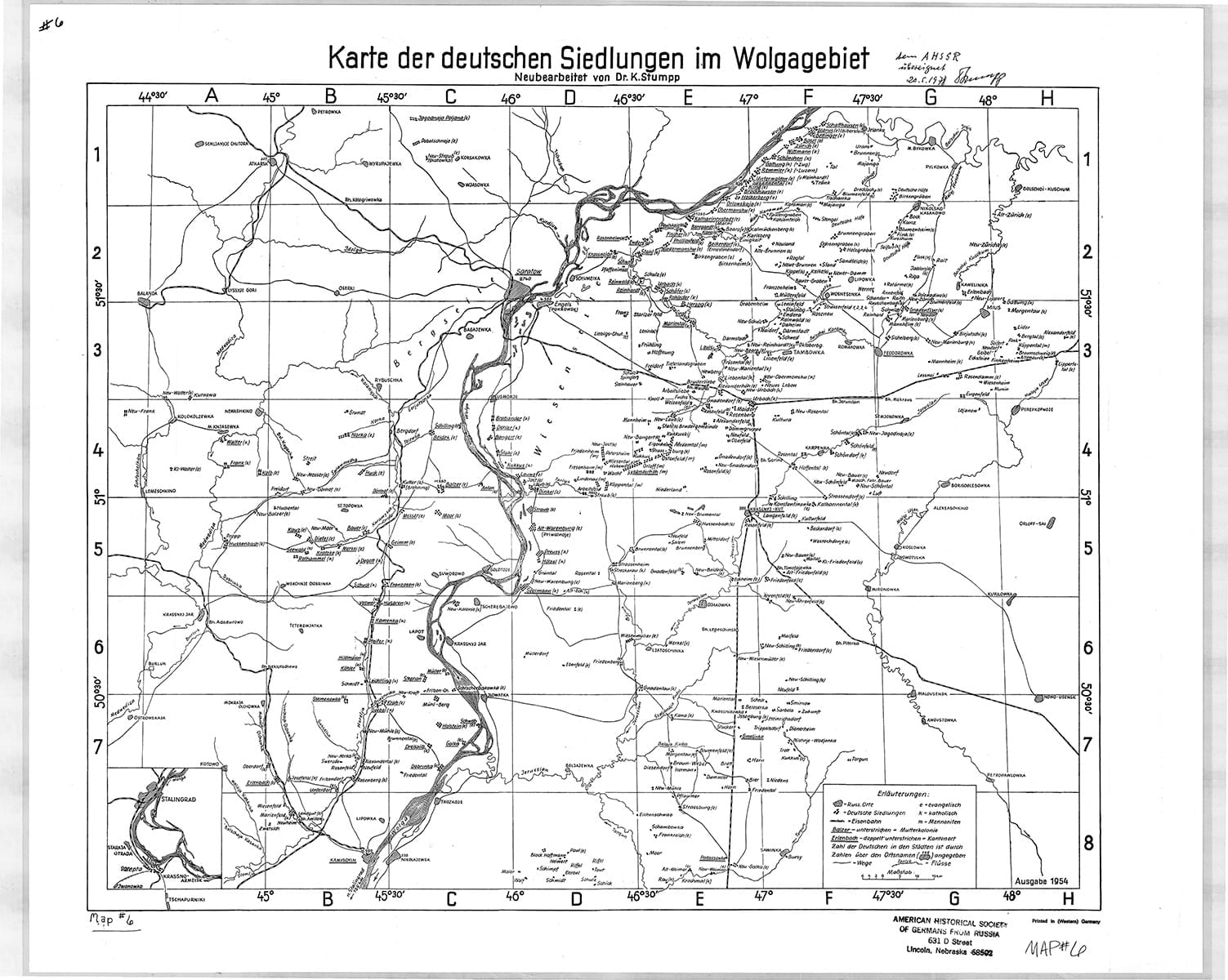
Map Of German Settlements In The Volga Area
(Karte der deutschen Siedlungen im Wolgagebiet)
Cartographer: Karl Stumpp
Size: 17 1/2 x 18 7/8 inches
The map extends from the northernmost German colonies of Yagodnaya Polyana and Schaffhausen, north of Saratov, to Kamyshin and Pallasovka in the south; from Balanda, Neu-Frank and Krasnyy Yar in the west to Alexanderfeld and Novouzensk in the east.
$13Members save $5.00!
Become a member