
Map #13 North & South Caucacus
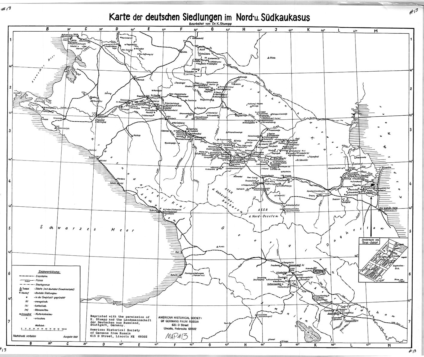
Map Of German Settlements In The North And South Caucasus
(Karte der deutschen Siedlungen im Nord und Suedkaukasus)
Cartographer: Karl Stumpp
Size: 22 x 17 inches
The map covers the area between the Black Sea on the west and the Caspian Sea on the east.
AHSGR Map # 13 Translation
Karte der deutschen Siedlungen im Nord- und Südkaukasus: Map of the German Settlements in North and South Caucasus
Bearbeitet von Dr. K. Stumpp: wrought by Dr. K. Stumpp
Schwarzes Meer: Black Sea
Zeichenerklärung: “character clarification” or Key
Eisenbahn: railroad
Flüsse: rivers
Staatsgrenze: national boundary
Städte (mit deutscher Einwohnerzal): cities (with German population)
deutsche Siedlungen: German settlements
in der Sowjetzeit gegründet: founded in the Soviet era
evangelisch: Protestant
katolisch: Catholic
Mennoniten: Mennonite
Mutterkolonien: mother colonies
erloschen: extinct
Maßstab: scale
Nachdruck verboten: reproduction prohibited
Ausgabe 1960: 1960 edition
Landsmannschaft der Deutschen aus Russland: Homeland Association of Germans from Russia
$13Members save $5.00!
Become a member