

Map #19 Frank, about 1900
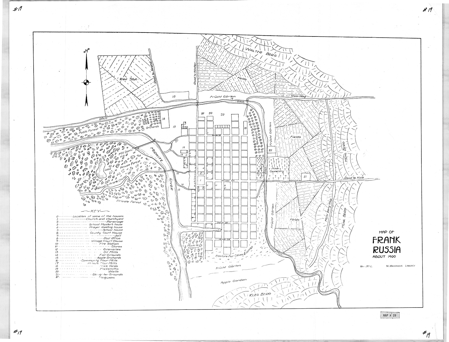
Map Of The Village Of Frank, Volga Region, Russia, About 1900
Cartographer: M. Magdalene Lebsack
Size: 19 3/4 x 16 3/4 inches
The map shows the location of fields, gardens, pastures, cemeteries, orchards, surrounding mountains, and some specific features including location of the church and parsonage, mill, granaries, courthouse, jail, post office, fire station, and some homes. (No homes, however, are identified by specific owners’ names.)
$13Members save $5.00!
Become a member