
Map #22 Dnepropetrovsk
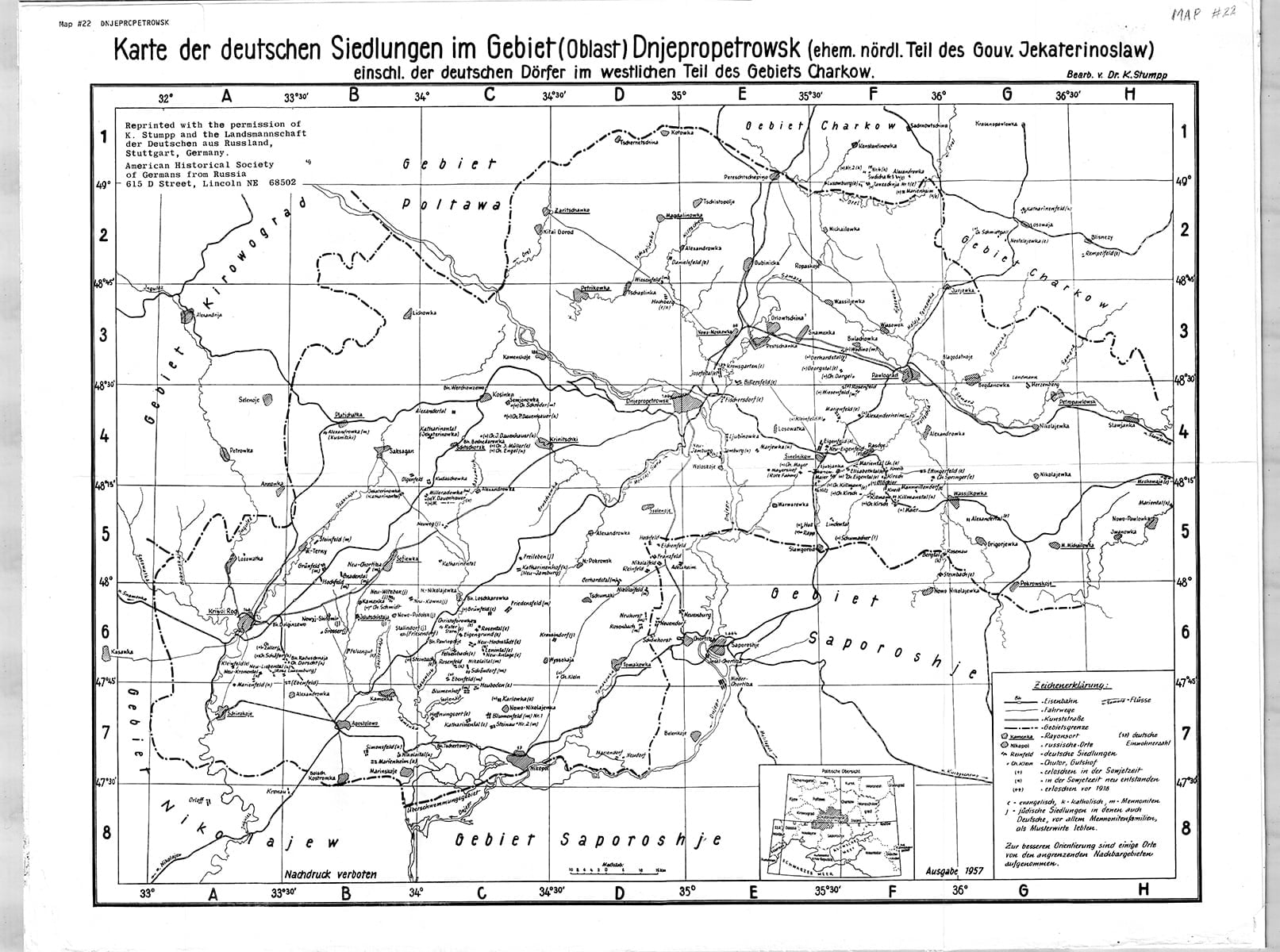
Map Of The German Settlements In The Dnepropetrovsk Oblast
(Karte der deutschen Siedlungen im Gebiet [Oblast] Dnjepropetrowsk ehem. nordl. Teil des Gouv. Jekaterinoslaw einschl. der deutschen Doerfer im westlichen Teil des Gebiets Charkow)
Cartographer: Karl Stumpp
Size: 22 1/2 x 17 inches
The map depicts the German settlements in the Dnepropetrovsk Oblast formerly the northern portion of the Province of Ekaterinoslav and includes the German villages in the western portion of the Kharkov Oblast.
$13Members save $5.00!
Become a member