
Map #25 Rostov
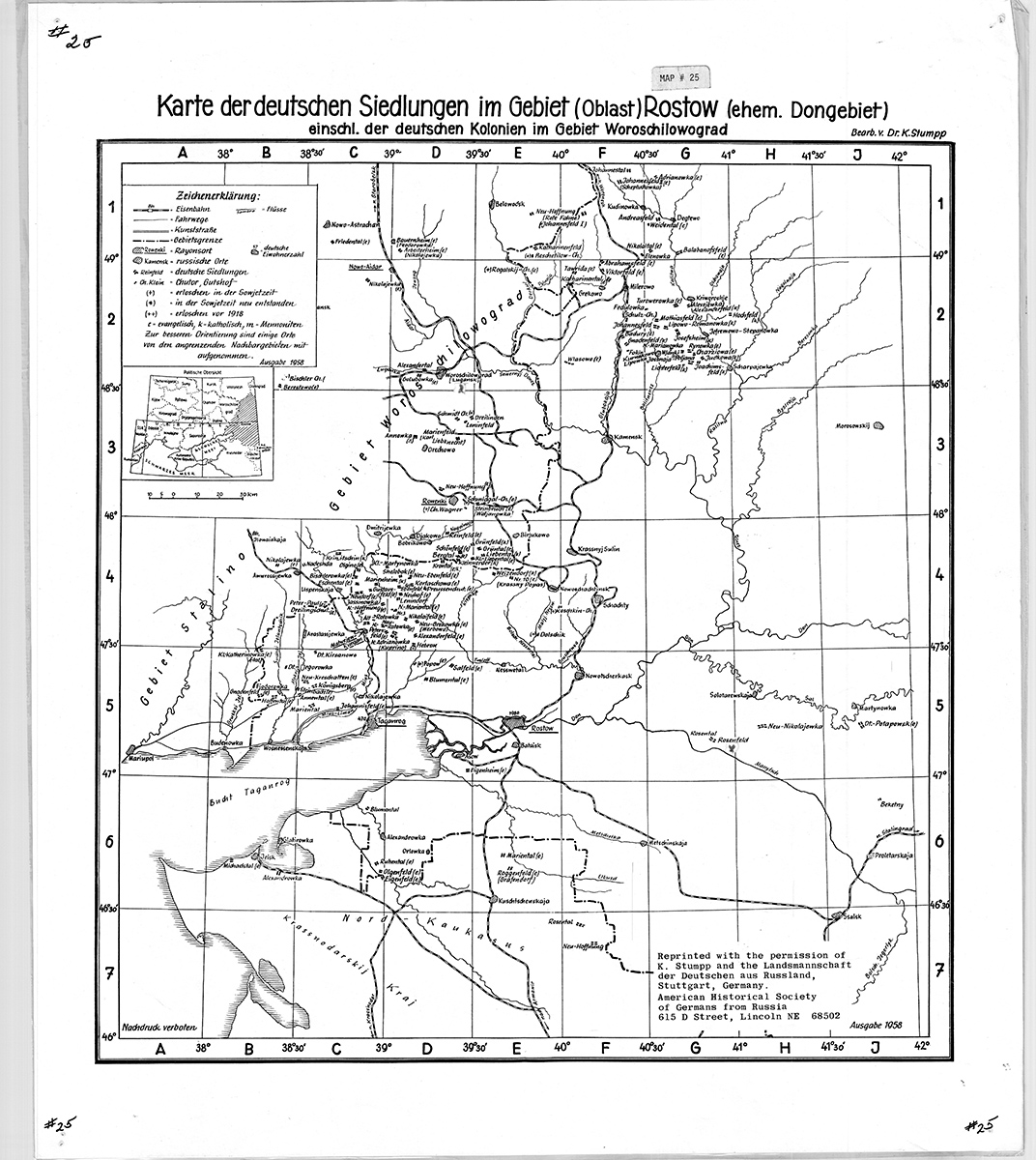
Map Of The German Settlements In The Rostov Oblast
(Karte der deutschen Siedlungen im Gebiet [Oblast] Rostow [ehem. Dongebiet] einschl. der deutschen Kolonien im Gebiet Woroschilowgrad)
Cartographer: Karl Stumpp
Size: 19 1/2 x 17 inches
This area was formerly known as the Territory of the Don Cossacks. It also shows German settlements in the Voroshilovgrad Oblast. (The city Voroshilovgrad was formerly Lugansk.)
$13Members save $5.00!
Become a member