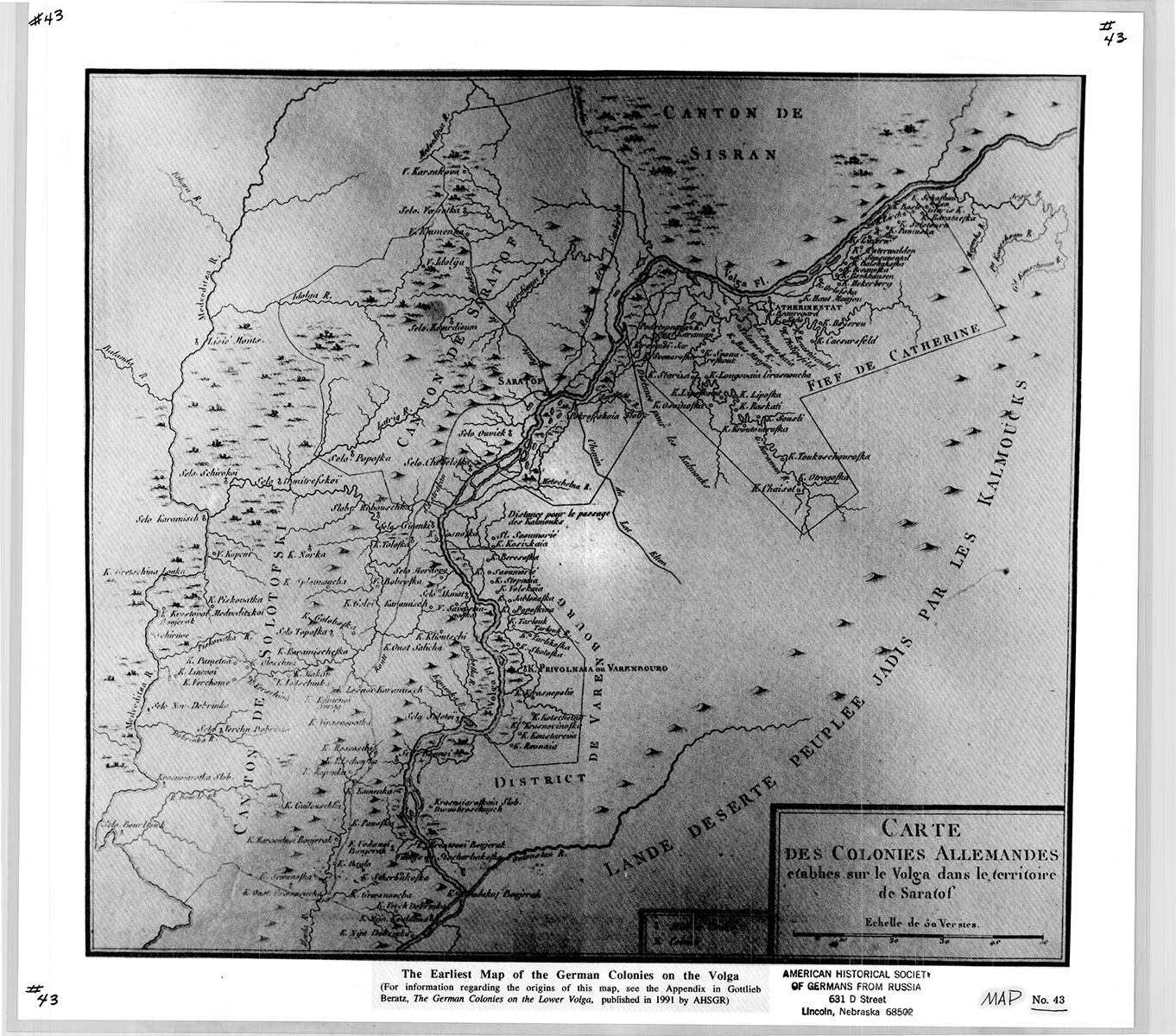
Map #43 Earliest Volga Colonies Map, 1770s (Beratz)
Although the exact origins of this map are unknown, it was probably drawn in the early 1770s.
Adam Giesinger discussed the map in the AHSGR translation of Gotlieb Beratz’s book The German Colonies on the Lower Volga: Their Origin and Early Development. Giesinger concluded that the map was prepared after the census of 1769 and before Caesarsfeld, Chasselois, Keller and Leitsinger were destroyed by the Kirghiz. This dates the map to the early 1770s. “There is little doubt,” Giesinger wrote, “that the map was prepared by one of the French Directors involved in the founding of the Volga Colonies, probably Baron Beuregard, or a cartographer who worked in his employ.”
Size: 17 1/2 x 16 inches
See Map #72 for a color version of this map.
$13Members save $5.00!
Become a member
